 Anacortes trails meander through 2,800 acres of forests, meadows, wetlands, lakes, and offer spectacular woodland and seascape views. With over 50 miles of multiple use trails it’s easy to choose a route to explore and find your favorite Fidalgo Island hike.
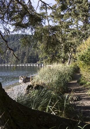
The Tommy Thompson Trail starts at 11th and Q Avenue, near the Port of Anacortes, and follows the old Burlington Northern Railway route for 3.3 miles. Most of the trail hugs the shoreline and has outstanding views of the Cascade Mountains and Mount Baker. It’s paved and fairly flat, which makes it popular for walking and biking. The southeastern portion crosses the railway trestle over Fidalgo Bay, which many consider the highlight of the trail. Along the route are access points, doggie bag stations and restrooms.
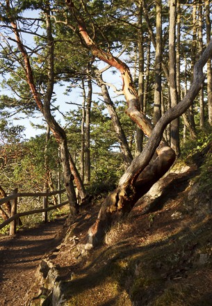
Cranberry Lake Area has a handful of trails. The main trail follows a 1.5 mile loop around Little Cranberry Lake with various off-shoots that lead hikers on different routes and into neighborhoods like Rock Ridge, which offers outstanding views of the San Juan Islands. At the southern end of the lake the trail continues past Little Beaver Pond, Big Beaver Pond and Mitten Pond. For the most part the trail is easy going, but it can get muddy and rugged in some parts. The most popular access points are at Cranberry Lake Road, which has a small parking lot and easily accessed view area of the lake and A Ave. with a large parking lot along the side of the road.
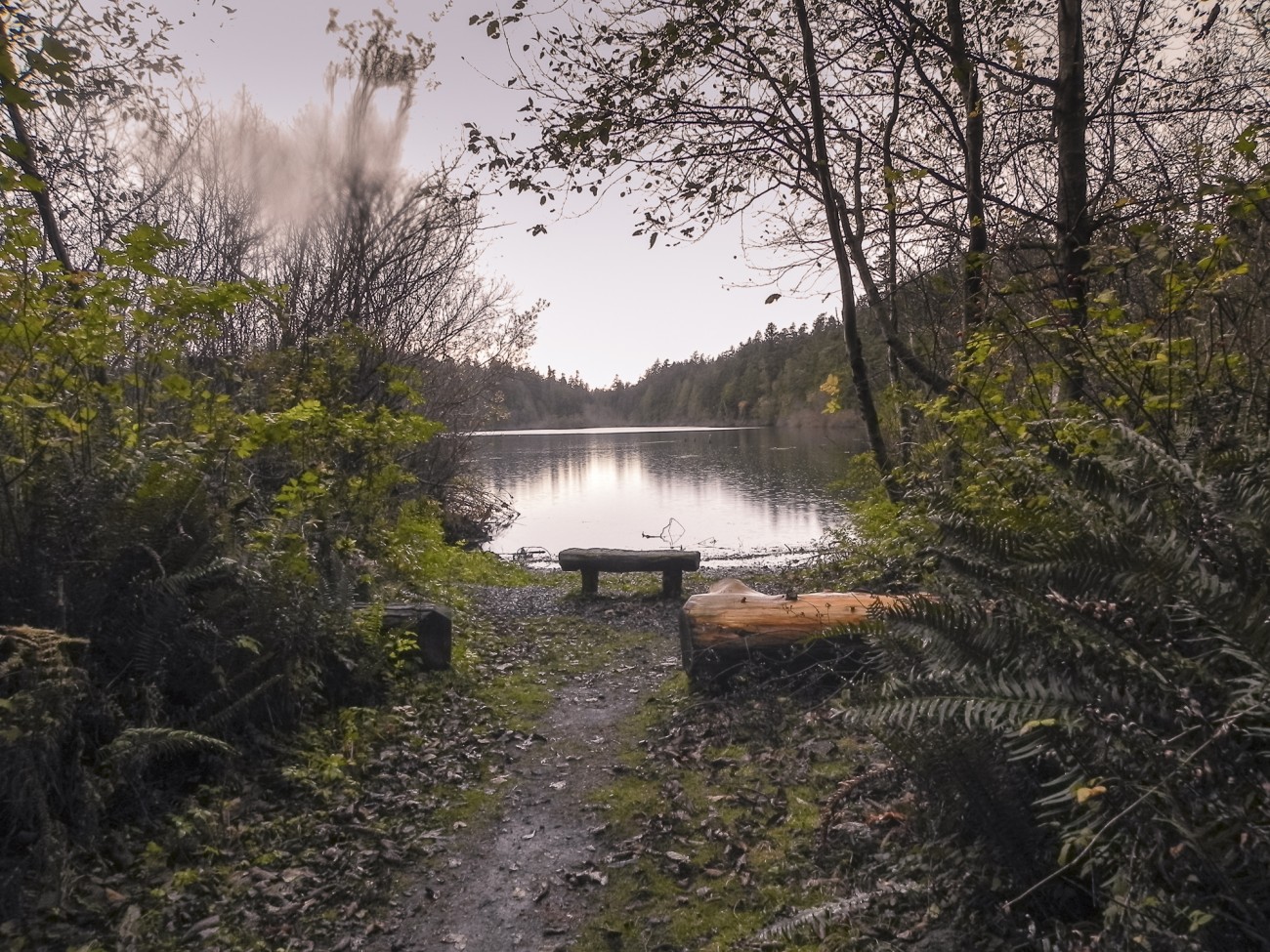 Heart Lake Trail is 2.86 miles long and almost does a complete loop around the lake through cedar and hemlock forests with pockets of views of the lake. The trail is easy and the lake is a popular spot for fishing, kayaking and families. On the weekends the voices of excited children can be heard as they discover the wonders of nature. There are several access points, but the large gravel parking lot off Heart Lake Road offers ample parking, restrooms and beach access.
Adjacent to Heart Lake is the Whistle Lake Trail system. This is the largest trail system in Anacortes Community Forest Lands and those desiring a longer hike can follow the trails from Heart Lake to Whistle Lake, or vice versa. Near Heart Lake are the two of the highest points in Anacortes: Mt. Erie at 1,273 ft. and Sugarloaf at 1,044 ft. There are pull-ins along Heart Lake Road but the best place to park is a gravel parking lot at the base of Mt. Eire, which also has a paved road leading to the top. For those wanting to start their hike at Whistle Lake, access is on the east side of the island off of Whistle Lake Terrace Road. There, the 3.7 mile trail passes by swamps, through wooded forests, a lake that gets warm enough to swim in the summer and rocky outcroppings.
Ship Harbor Interpretive Preserve Trail hugs 2000 ft. of Ship Harbor’s sandy beach shoreline. There are interpretive platforms and benches to ponder the views of the ferry, birds and islands. A boardwalk, completed in 2013, leads visitors through a portion of the wetlands and the 25 acre perimeter of freshwater wetlands. Travel west on Hwy. 20 until Ship Harbor comes into view, then turn right onto Ship Harbor Boulevard, take the next left and wind down to a cul-de-sac next to Guemes Channel.
In that same cul-de-sac is Guemes Channel Trail, which will eventually connect to downtown Anacortes and the Tommy Thompson Trail. The newest section of the trail opened in May 2015 and extends to Illinois Avenue. The trail is paved and follows the old railroad bed along Guemes Channel.
Washington Park is on the western point of Fidalgo Island and has handfuls of trails that lead through 220 acres of forest to breathtaking views of the Olympic Mountains and San Juan Islands. At Juniper Point, on the southwestern tip, is a bench and harbor porpoises can often be seen surfing in Burrows Bay Channel. Be aware that parts of the trails are steep and rooty. For a paved, yet hilly walk, take the 2.25 mile loop that curves through the park. Green Point, a grassy area on the northwestern tip, is easily accessed from the paved road and a good place to watch boat activity or climb on the shoreline rocks near West Beach. Follow Hwy. 20 past the ferry, continue down Sunset Ave. to the large parking lot at the end. There is also beach access, restrooms and a playground.
Sharpe Park and Montgomery-Duban Headlands Trail is a 2.6 miles loop with some rough-and-tumble hiking through the largest undeveloped and privately owned waterfront on the island. The trail passes through 110 acres of marshlands and woods with large firs and madrones, and offers scenic viewpoints of Lopez Island, the Olympic Peninsula and 400 ft. headlands rising from the sea. There is only one access to the trail. From Hwy. 20 turn left onto Rosario Road and follow it for 1.7 miles to a pull-in parking lot on the left side of the road.
Note: Anacortes Forest Land trails are numbered and no pass is required. Maps can be purchased at the City of Anacortes and the Visitor’s Information Center.
Rosario Head, Bowman Bay and Pass Lake are part of Deception Pass State Park and part of the Pacific Northwest Trail. For Rosario Head and Bowman Bay the trails can start and end in either location. The length all depends on how long of a hike you want to take. For a shorter hike follow the trail to Rosario Head, past a pole carving of the Maiden of Deception Pass and around the .3 mile rocky point loop with views of Rosario Strait, Deception Island, Whidbey Island and the Olympic Mountains. The trail does follow the cliff sides and can be steep at times so it is important to keep an eye on small children and pets. Urchin Rocks, on the south end of beach, is a good place to explore the tide pools. From Hwy. 20 turn left onto Rosario Road, then turn left onto Cougar Cap Road and another left onto Rosario Beach Road. This leads to a large parking lot with picnic tables and bathrooms. Please note this park closes in the winter. Click here for the Deception Pass Trail Map
 The trail at Bowman Bay is also accessed from Hwy. 20. Turn left onto Rosario Road, take the first left turn onto Bowman Bay Road and follow it to a large parking lot with large grassy field and a playground. For a longer hiker take the Pacific Northwest Trail from Rosario Head all the way to Bowman Bay. At Bowman Bay, it rambles between shoreline and marshlands, up a rocky cliff and then down toward a small beach in Lottie Bay. One way will loop around Lottie Point and the other around Lighthouse Point. To access the Lighthouse Point trail, cross over the beach at Lottie Bay and reconnect at the other end. This portion of the trail offers spectacular views of Deception Pass, Canoe Pass and Deception Pass Bridge. The trail from Bowman Bay is around 2.6 miles, and from Rosario Head it is around 5 miles roundtrip.
The Pass Lake Trail parking lot can be seen from Hwy. 20 and is almost right across the street from the turn-off to Bowman Bay Road. Follow the 2.8 mile loop along Pass Lake and then up through the ferns, salal and fir trees where it peaks and then weaves back down through a recent timber harvest. Extend the route one mile with the Ginnett Hill Trail at the end of the lake to an old homestead site. This lake is fly-fishing only and on weekends the parking lot can fill up.
Note: A Discovery Pass is required at all Deception Pass Park locations.